Optimizing Our Streets
A 300-year Journey
Every urban planner who has worked in downtown Mobile over the past 20 years has marveled at our near-perfect 300-year-old street grid with its short, evenly spaced blocks. The only way to improve it, they said, would be to convert as many one-way streets to two-way travel as possible. This, after all, was how the streets were originally designed. It was only in the middle of the 20th century that traffic engineers, with directives to move as many cars as quickly as possible into and out of downtown, developed the one-way traffic patterns most of us grew up with.
In the process, retailers and service providers in our then-struggling urban core struggled even more. Businesses in a downtown setting need pedestrians and high visibility, both of which are reduced in a higher-speed traffic environment. Shoppers and diners, especially those from out of town, need a simple traffic pattern, without all the confusion and extra driving one-way streets require.
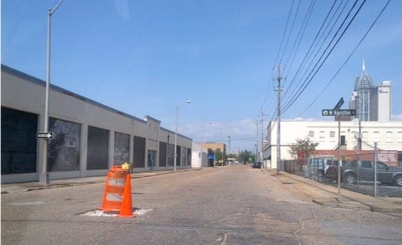
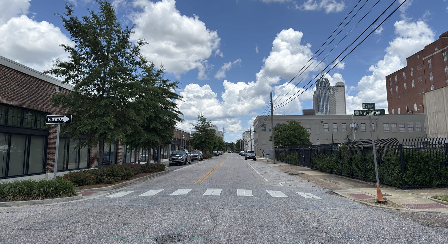
To support the revitalization of downtown Mobile that was underway in the mid-2000s, then-Mayor Sam Jones adopted a plan to convert several streets to two-way travel. Seemingly overnight, cars could travel on Royal Street, St. Francis Street, and St. Louis Street in both directions. A portion of St. Joseph Street soon followed. Most of us don’t remember how desolate those streets were prior to the change. However, few streets, if any, in the entire city have seen the kind of resurgence experienced on St. Louis Street as is illustrated in the before and after photos below.
Because two-way travel organically slows down vehicles, the streets became safer and more welcoming to pedestrians. Drivers were going slow enough to notice a new business or be reminded of a business they hadn’t visited recently. Two-way traffic created a more direct route to businesses and residences, eliminating the diversions that one-way patterns require. A street with little activity became an economic powerhouse in part because the correct design was restored.
The current Street Optimization Plan was developed to expand the success of those early conversions, both in safety and economic activity. Noted architect and urban planner Jeff Speck and his team examined every inch of our street grid and met with downtown stakeholders in large and small groups (via Zoom since the process occurred during the COVID-19 disruptions in 2020) for input. The resulting plan was adopted by Mayor Sandy Stimpson and was sent to Volkert for detailed design and engineering.
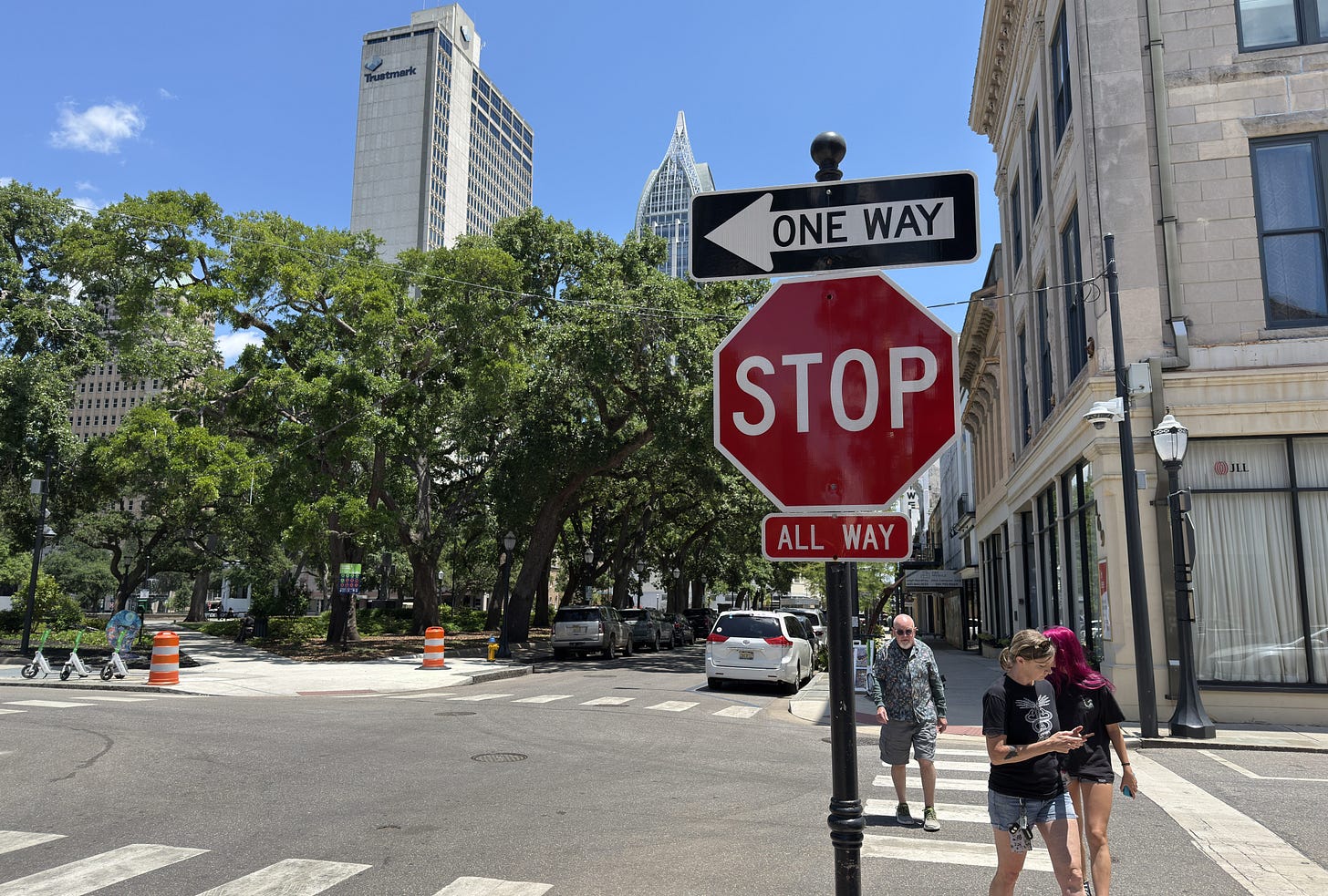
The implementation of the plan by the City of Mobile began earlier this year, when some traffic signals were replaced by all-way stop signs. Drivers adjusted quickly, and today most of them wouldn’t remember where those traffic lights once were.
The next phase will remove more signals, convert more streets to two-way travel, and add on-street parking. The width of our historic streets will require a “yield street” type of traffic flow with parking on both sides of the street and vehicles pulling to the side when an on-coming car approaches. Anyone who has ever driven in Mobile’s historic neighborhoods has experienced this kind of street design. Below is a recent photo of a yield street in the Leinkauf Historic District. The street is home to residences and businesses, much like our downtown streets. Drivers navigate this pattern all the time without thinking twice.
The journey to creating a safer and more economically productive street grid has been a long one, and the transition will require a bit of patience and increased driver diligence in the short term. The payoff, however, can be transformational, and the opportunities for development and activation will help sustain the ongoing redevelopment of our beautiful city center. And, after all, who wouldn’t appreciate not having to wait at a red light at an otherwise empty intersection??


